Category Archives: Uncategorized

Little Woodrow’s Timeline

Bars that earn more than 50% of their revenue from alcohol sales must operate on land with special CS-1 zoning. They also need a conditional use permit that may impose conditions for operation. Rick Engel, the Little Woodrow’s owner, started out over a year ago by seeking the rezoning to CS-1. Brentwood Neighborhood Association and adjacent neighbors opposed, but City Council in February 2013 voted 5-2 to approve the rezoning. Council Members Morrison and Tovo opposed.

As part of that vote, Mayor Pro Tem Sheryl Cole held last-minute negotiations between Engel and some adjacent neighbors that locked down terms to be applied to the conditional use permit. The CS-1 footprint was reduced from 8,000 sq ft to 5440 sq ft (the amount that the bar actually needed), and these residents agreed to accept 2 AM operating hours on weekends and holidays.

However, most stakeholders including the Brentwood and Allandale neighborhood associations were not part of this negotiation and continued to oppose the bar. In December, Planning Commission in a 2-3 split decision failed to approve the conditional use permit. Two commissioners voted to reject the permit, and three voted to approve based on staff’s recommendation of stricter conditions on hours, parking and noise.

Little Woodrow’s then appealed to Council.

My Neighborhood’s Character is Great for Children

by Heather Way
Which Way Austin
1/24/2014

Austin’s CodeNEXT team (the team that is leading an overhaul of the City of Austin’s land use code) is currently conducting an assessment of our city’s community character. The team wants to know what the Austin public values about our neighborhoods, favorite places, and opportunities for improvement, with a focus on the built environment.

There is a final city workshop tomorrow where Austinites can offer their input on the community character assessment, and then later this month the City will be rolling out a “do-it-yourself” Neighborhood Community Character kit.

I hope that lots of Austin’s families are weighing in on this assessment. What about our neighborhoods’ unique character supports families’ ability to raise children, and what makes it hard to raise children? What do we like and not like about our homes, our streets, our public spaces, and our businesses?

Here is my (partial) list of things I love about my community’s character, with a focus on the things in my neighborhood that contribute to my family’s happiness and well-being. What does your list look like?

IMG_0405_1

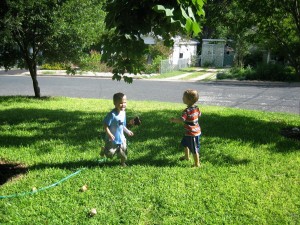
1. Yards: I love my neighborhood’s backyards and front yards. With the focus on densifying Austin’s urban core, what often gets lost is the importance of providing safe places for kids to engage in free play outdoors. Outdoor play is a critical part of a child’s development and a parent’s sanity. In a household with two rambunctious boys, I don’t know how we could have survived raising kids so far without being able to send our kids outdoors to run around and play–while also being able to keep a close eye on them when cooking dinner, working at home, etc. In fact, the only reason I have been able to write this blog post today (since school was cancelled) is because I could send my kids and their friends into the yard to play.
IMG_2308
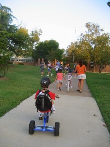
2. Neighborhood school and park. When we first bought our house, before we had children, we did not realize at the time what a blessing it is to live within walking distance of an outstanding neighborhood school that was next to a park. Now that we have school-age kids, we are thankful everyday for living so close to such a community treasure that we can walk and bike to each day. Beyond the educational benefits, both our neighborhood school and park have fostered tons of new friendships with our neighbors, a greater sense of neighborhood identity, and community stewardship.

3. Affordable, family-friendly restaurants. When my kids were younger, it was important for us to be able to go to restaurants with outdoor play areas for children. Now that my kids are older, a family-friendly restaurant is one that serves affordable, healthy, and kid-friendly food within walking or cycling distance of our home.

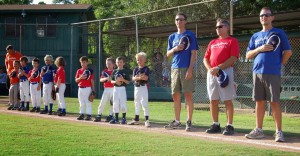
4. Access to parks and athletic facilities. I love the fact that my neighborhood is close to great parks as well as athletic facilities where our kids can play baseball, soccer, tennis, and more.
Image 1
IMG_0426
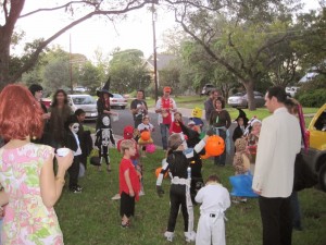
5. Eclectic, artistic and diverse character. I love living in a neighborhood where my 80-year-old neighbor can grow a field of corn in his front yard, where there are art cars parked in the driveways, and where multiple generations live on a street. I cherish the fact that our neighborhood includes affordable housing, including public housing for families and MHMR housing for persons with mental disabilities. And I appreciate all the artwork in the neighborhood, including the hand-knitted artwork on the stop sign pole, the mural in the alley, and other artwork gems that pop up in nooks and crannies throughout the hood.
IMG_2208
6. Cul-de-sacs. While cul-de-sacs are generally shunned in urban planning circles, I love my neighborhood’s cul-de-sacs. Our cul-de-sacs offer the safest places for kids to play in the streets, learn to ride their bike, shoot hoops, roller skate, and more. Studies have found that cul-de-sacs result in a substantial increase in play activity compared to an open grid street pattern, and the Atlantic Cities recently ran this great article on how cul-de-sacs increase social interaction among neighbors. Here’s to the cul-de-sac!
7. Back to nature. I love going to sleep at night to the sound of an owl hooting in my back yard, and then waking up on in the morning to the sound of a woodpecker. I love the canopy of trees that line our streets, the butterflies that appear in our flower beds, and the lizards that appear on our front porch.

http://whichwayaustin.blogspot.com/2014/01/assessing-austins-community-character.html

The Domain in Photos: the Good, the Bad, and the Ugly

by Steven Zettner, editor

Perhaps more than any other issue, most of District 7’s neighborhoods share North Burnet Gateway as a common opportunity and risk. As goes Austin’s second downtown, so too shall go the adjacent neighborhoods.

During the campaign I’ll be coming back to North Burnet Gateway several times. But I wanted to start with visuals – a quick photo tour of The Domain along with some observations.

THE GOOD

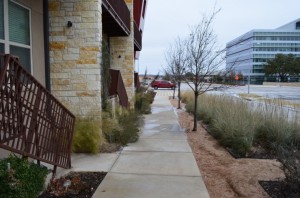
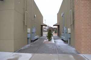
Oddly, the most enchanting place during my walk of The Domain was this sidewalk next to an apartment complex. The quirky hand rails, attractive landscape and nice stone work gave it an uplifting feel. (Click photo to expand).
DSC_0106_15
Not far from the same spot, I found these streetscape features inviting.
DSC_0108_15


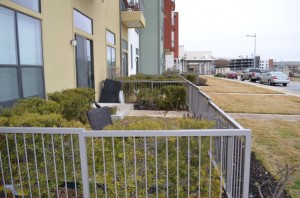
These ground-floor patios are, if they get used, a great way to put people outdoors where they can interact and meet their neighbors
DSC_0086_15
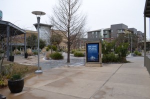
This is one of The Domain’s main gathering places. It’s rich in features – an attractive place except for all the heavy-handed muzak and advertising
DSC_0067_15


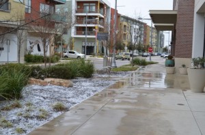
The Domain’s sidewalks are far and away its best feature
DSC_0070_15
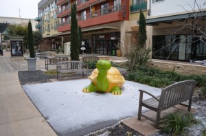
A fun play feature for kids. Unfortunately, it was the only one I encountered on my hour-long tour. Another parent I talked to said The Domain has many kid-friendly features and draws parents from adjacent neighborhoods, so watch for more on this theme.
DSC_0066_15


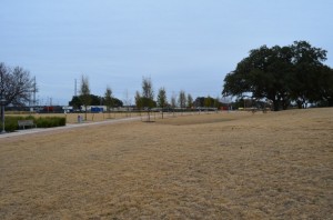
This is The Domain’s main park. Park space is a big concern – North Burnet Gateway could end up with half the public space of Downtown Austin. The Domain got public subsidies, but other developments in NBG probably won’t.
DSC_0096_15


THE BAD

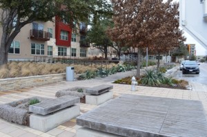
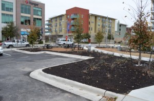
This finger of open space juts out from an apartment complex. The benches are intended to provide a respite on a path leading to the shopping district. But there’s not enough pedestrian space to make it work; the tables are too exposed to wind and traffic for most people to use them.
DSC_0077_15
Here’s a useful feature – a mini dog-park behind an apartment complex. So why put it in the ‘Bad’ category? It shows up a major weakness of The Domain – no housing suitable for families. North Burnet Gateway residents will be permanently segregated by age.
DSC_0080_15


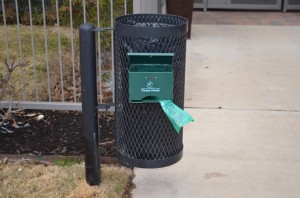
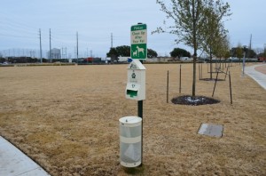
A ubiquitous dog poop station.
DSC_0085_15
Hmm – another dog poop station.
DSC_0097_15


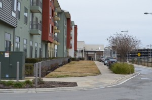
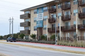
Here’s the housing at The Domain. Live-Work-Play – if you’re an adult. (Or a dog. Can you spy the poop station?)
DSC_0113_15


THE UGLY

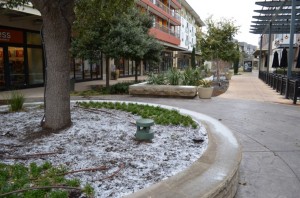
Confused why this is Ugly? It’s the little green doo-whichee – an outdoor muzak speaker. They’re everywhere! Adds Orwellian charm to your upscale shopping spree.
DSC_0064_15
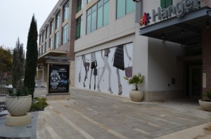
The Domain feels like a Madonna MTV video. It’s probably not a big deal for occasional visits, but I’d be concerned about raising my kids in a place with wall-sized murals to buy fancy clothes and watches.
DSC_0065_15


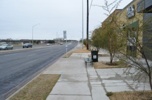
This streetscape along Braker looks eerily like what the City of Austin wants to put on other corridors – a 15′ tree and sidewalk zone. It’s functional – for adults. But few people use this because Braker is too scary.
DSC_0055_15
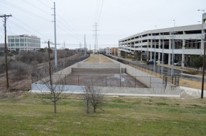
This detention pond is where the North Burnet Gateway master plan shows conceptual open space. As implemented, it’s a walled off abomination.
DSC_0058_15


This commercial center along Braker meets all the North Burnet Gateway zoning requirements, including 2% open space. In case you didn’t get it, this is the site’s 2% open space.
DSC_0054_15
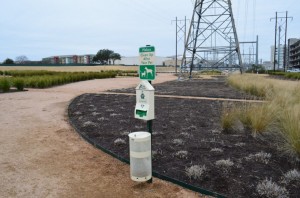
We’re back at The Domain’s main park, this time looking west – at the transmission towers and Austin Energy sub station. (In fairness, one hopes that at some point the sub station will be screened off by shrubbery).
DSC_0098_15

Here Comes Rapid Buses on Lamar, Burnet

By Richard Whittaker, Austin Chronicle, Jan. 24, 2014

“If you give people good coffee and good tunes, they will park and ride.” In 1992’s ode to progressive Seattle, Singles, that’s how transportation planner Steve Dunne sells the idea of commuter rail. Replace coffee with comfy seats, and tunes with free wi-fi, and that’s how Capital Metro hopes to sell its newest development, MetroRapid buses, to Austin’s ever-growing business commuter community.

This Sunday, Jan. 26, Cap Metro will launch its first MetroRapid service: the 801, an express route from Tech Ridge to Southpark Meadows, linking Lamar, Guad­a­lupe, and South Congress. It’s one more component of Project Connect, the joint initiative between the city of Austin and Cap Metro to construct a genuine rapid mass transit system involving express buses, and light and commuter rail. The plan is to create a fast, clean, modern alternative for commuters – and in the process take some of the increasing strain off Aus­tin’s overburdened roads. As the first local example of bus rapid transit (BRT), Cap Metro president and CEO Linda Watson called MetroRapid “somewhere between bus and rail. … It’s smart buses, operating on smart streets, stopping at smart stations.”

The plan is to get 21,000 boardings a day on MetroRapid within the first 24 months. It should be easy for those passengers to spot the new service. At 60 feet, the vehicles (transit staff try to avoid the word “buses” for them) are half again as long as the normal Cap Metro rolling stock. The other clue is that these are “articulated” buses; they look like two buses glued together, with an accordion in between. That means the back and front move independently, earning the nicknames “bendy buses,” “caterpillar buses,” and “Slinky buses.”

A common sight in many American cities, including Minneapolis-St. Paul, Chi­ca­go, and Houston, they look cumbersome, but in the hands of an experienced driver they actually handle a little more easily than the regular 40-footers. Inside, the vehicles don’t look like the aging and crowded units they’re replacing; they’re airy and spacious, with taller ceilings, higher windows, more seat padding than regular buses, plus free wi-fi. There are also wider-than-standard doors, and more of them. Unlike regular Cap Metro buses, where passengers can only embark at the front, passengers will be able to get on and off through any door. That’s an important part of their design: With three doors, plus card readers and mobile phone scanners at the two rear doors, a MetroRapid bus can load and unload more quickly.

First of Many

That’s half of the equation. The other half is the stops – or, in MetroRapid lingo, “stations.” Spacious, shaded, off the sidewalk, and with digital displays giving real-time arrival information, they’re located at the biggest apartment complexes, or the biggest firms and office complexes. There will also be bus “priority lanes” on Guad­alupe and Lavaca, and MetroRapid vehicles will communicate with lights at crossings to keep them green longer for bus passage. Combine everything, and Cap Metro hopes that a host of non-traditional bus riders will be coaxed to park and ride. Watson said, “Everything is geared to be rapid.”

More at:

http://www.austinchronicle.com/news/2014-01-24/here-comes-metrorapid/

Booming Austin Sees Costs of Living Skyrocket

The Associated Press
1/05/2014

AUSTIN, TX — Austin is on a winning streak, amid twin booms in economic and population growth. But a published report Sunday says the city’s success has also made its cost of living more expensive – so much so that some longtime residents and recent transplants alike are being forced out.

The population grew from an estimated 674,000 in 2003 to 830,000 last year. Some suburbs, like Round Rock, grew even faster, making Austin among America’s fastest-growing large metro areas. In August, Forbes magazine ranked the Austin area second among cities nationwide for job growth.
The increasing population has bolstered local attractions, including the South by Southwest festival. But that, in turn, has attracted still more people, driving living costs higher and prompting some residents to leave, according to The Austin American Statesman.

That includes Gin Daniel, who moved to Austin in the mid-1990s but moved last year to a small town in East Texas after the owner of her apartment complex just west of downtown sold it and the rent tripled.

“I stayed as long as I could,” Daniel said. “I love Austin, but I just couldn’t afford it anymore.”

Some say the rising prices undercut many of the notions ingrained in the city’s ethos. Nonetheless, a study last year by Jed Kolko, chief economist for Trulia, a national online real estate site, found Austin is among the most expensive places for someone earning a median wage in a particular city.

Kolko concluded that only half the homes for sale in Austin are within reach of a household earning a typical salary, a smaller percentage than in all but 13 of the top 100 metro areas.

Incomes have also risen in the area, but when income gains are measured against housing costs, the trend is headed in the wrong direction. Median family income in the Austin area increased 13.5 percent from 2003 to 2012, while median home prices increased 31.3 percent and average rents increased 43 percent, according to the Texas A&M Real Estate Center.

Rising costs have undermined other municipal initiatives – including a 1990s effort to improve long-blighted East Austin by providing federal subsidies for a new, affordable subdivision in the Govalle neighborhood. The goal was to attract buyers who would get a discounted home in exchange for staying for years in a rough part of town.

Courtney Enriquez was among the buyers. But as the Eastside has developed a hip bar scene, things got too expensive. Enriquez and her husband moved to Smithville, 40 miles east of Austin, in November.

This school year, meanwhile, the Austin district shrank by an estimated 1,200 students, marking the district’s first net loss in more than a decade.

As the city’s inner core gets more expensive, the poor are being pushed to the suburbs.

The number of people living in poverty in the Central Texas suburbs rose 143 percent between 2000 and 2011, outpacing overall suburban population growth, according to a 2012 book by authors with the Brookings Institution in Washington.

http://abclocal.go.com/ktrk/story?section=news/state&id=9382386

Austin Needs A Different Way to Prioritize Park Space Gaps

by Steven Zettner, Editor

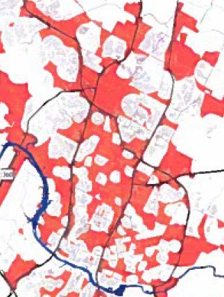
Availability of public space will strongly influence the success or failure of ‘transit-oriented’ development now emerging throughout the city. A few years ago, City Council in response to a report of the Families and Children Task Force directed the Parks Department to draw up a plan to provide a park within 1/4 mile of every residence in the urban core, and within 1/2 mile of areas beyond it. This was a badly needed first step. But the plan needs to be refined.
PARD park priority gap map

This map from the Parks Department’s urban park implementation plan shows the areas in red that are not within a quarter mile (urban core) or half mile (beyond urban core) of existing or potential park space.

There are flaws in the methodology used to develop this map. Practically any scrap of public land counts towards eliminating a “gap”, regardless of whether it is sufficient to serve a function appropriate to the area. In reality, the gaps are far greater than the map implies. The N Lamar/Rundberg area is a great example, where a handful of small peripheral parks or school grounds serve a dense community.

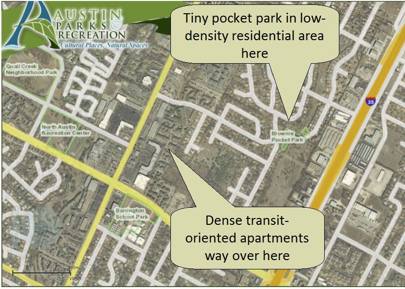
Some parks are located in quiet residential areas, but the gap analysis counts them as serving adjacent high density areas. This implies a random flow of people drawn into the residential areas, and away from transit or destinations. What needs to happen is the reverse – the park should be drawing people out of the residential areas, towards transit and shops. Drawing people INTO the quiet residential areas will cause nuisance problems, without contributing to the City’s ‘compact and connected’ goals.

Pocket park gap slide

Brownie Pocket Park – in the wrong place to support dense apartments along N Lamar

An example is Lucy Reed park in Allandale, which supposedly supports the entire Northcross mixed use district along Anderson. Pedestrians would have to cross school grounds into a quiet residential area – if they could even reach the park which is blocked from Northcross by a creek.

Another flaw is to put North Burnet Gateway and the Rundberg area outside the urban core, and thus not subject to the 1/4 mile access rule. NBG is intended to be a dense, highly walkable, transit-oriented district. It needs a denser distribution of parks. Rundberg is already one of the densest areas in Austin.

The plan should be reassessed with account of function. Some transit-oriented areas will need a community gathering space, others a small playground, a soccer field or a dog park, or creek-land buffering and trails for the perimeter of a community. Function and utilization, not chance availability of land, should determine park size and location.

Parks Department has been on a starvation diet for so long that there may not be much stomach to make the acquisition program more aggressive, when existing parks can’t even be maintained. But that thinking is a self-defeating one. We need to get the parks in the places where they contribute to connectivity and get amazing utilization – then the maintenance funding will come.

NPR: Austin’s Traffic Is REALLY Bad

by Wade Goodwyn
NPR, 12/17/2013

Four decades ago, Austin, Texas, had a population of 250,000 and a reputation as a laid-back oasis of liberal politics and live music. Today, the Austin metro area is home to 1.8 million people and has some of the nation’s worst traffic congestion.

For years, the city has done little to address the growing problem. But most in the Texas capital now agree something has to change if Austin is to save what’s left of its quirky character.

The best way to experience Austin traffic may be from inside the police department’s new helicopter. Breathtaking in the late afternoon sunlight, the state Capitol and the University of Texas Tower glow like torches.

But tear your eyes away from the skyline to look down and — poof! There goes your pretty picture. Nearly everywhere you look, the roads are backed up with cars, pickup trucks and 18-wheelers crawling along.

Police officer Ryan Miller is up in the sky nearly every day, and he says he has seen Austin’s traffic grow exponentially worse during the past five years. Now, a large portion of the city’s inhabitants must plan their daily activities with the traffic in mind.

Mayor Lee Leffingwell, a native Austinite, says he’s watching automobile traffic slowly ruin his beautiful city.

“There was kind of an epiphany — a moment in time when we realized that we are going to have to quit ignoring the problem, which we’d done for so many years in the past,” Leffingwell says.

An ‘If We Don’t Build It, They Won’t Come’ Mentality

While Austin fiddled decade after decade, Dallas was busy building the largest light rail system in the country. Thirty years later, the Texas city with the conservative reputation has the regional mass transit network, not Austin. Austin has done practically nothing in that regard.

“I think that is a fair statement,” Leffingwell says. “There’s a very strong no-growth movement in our city. And that applies not only to transportation but other infrastructure.”

Leffingwell says that view can pretty much be summed up as, ” ‘If we don’t build this water plant and we don’t have enough water, they won’t come. If we don’t build this power plant and we don’t have enough power, they won’t come.’

“And that is absolutely wrong in my view,” he continues. “The growth trend has been steady and constant since 1870, and there’s no indication that anything is going to change.”

In fact, the Austin metro area is predicted to double in population over the next 25 years to 4 million people.

The Texas A&M Transportation Institute has built sophisticated computer modeling of Austin’s future traffic — and the findings are not good. The commute from downtown Austin to the northern suburb of Round Rock currently takes about 45 minutes during rush hour. But by 2035, the institute estimates, it will take two hours and 30 minutes to go those 19 miles.

Perhaps nobody knows more about Austin traffic than Texas A&M’s Tim Lomax. The transportation planning expert says Austin’s relentless growth overwhelms all potential solutions.

“The technical word we use is ‘awful,’ ” Lomax says. “If you do all of the scenarios that we normally think of as transportation improvements, it’s still going to be awful.”

Trying To Lure Drivers With Speed

Austin is the largest city in America with only one interstate running through it. Just six lanes wide through downtown, Interstate 35 backs up for miles regularly.

A tolled bypass to the east of Austin was supposed to help relieve the bottleneck. But Texas state Highway 130 was built so far to the east that practically nobody uses it.

In desperation, the state raised the toll road speed limit to 85 mph, the fastest in the nation. The idea was that drivers could drop the top, drop the hammer, crank the music and fly right past Austin.

It’s a beautiful, wide-open highway — but it’s empty, and the builders are nearly bankrupt. So now, the state is considering tolling Interstate 35 and making the toll road free — as well as building a light-rail system and putting in more bike lanes.

But Lomax says his computer models show the only real solution is going to involve changes in behavior and lifestyle.

“We did some modeling to suggest the kind of magnitude of change,” he says. “We used a giant hammer on the travel model. We took away 40 percent of the work trips. We said those are going to happen somehow, but they’re not going to happen in a car.”

To keep traffic flowing in his sophisticated models, Lomax plays God of Austin.

“We said, instead of people driving on average 20 to 25 miles to get to work, now they’re going to drive five, six or seven miles to get to work,” he says. “That says there’s going to be a massive shift in jobs and population.”

If Austin can do all that, Lomax says, the roads and highways in his computer models stay the color green — traffic still flowing. But without those drastic changes in behavior? The entire region turns into red capillaries of doom, with everybody crawling along everywhere almost all the time.

Like many in Austin, businessman Kevin Tuerff moved here to attend the University of Texas and never left. Ten years ago, he bought his dream home in the Austin Hill Country. Traffic has become a mess as the population has exploded.

By last year, Tuerff was fed up with two hours on the road every day. Now he rents a high-rise apartment in a gleaming new building downtown.

“My office is about five minutes by car or 12 minutes by bicycle,” he says. “And that’s what I love about this place.”

Tuerff is part of that 40 percent that Lomax needs to make his transportation models work. And there’s a growing population of successful professionals paying $3,000 to $5,000 in rent every month for the privilege of walking and biking to work and play.

But what about Austin’s many musicians and artists — and, in fact, everybody else?

‘The Velvet Rut’

“I used to feel like I could go anywhere in 12 minutes,” says Amy Scofield, a successful artist who has lived and worked in Austin for more than 22 years. “And I still have that mentality, and now I’m late all the time. And I’m stressed out all the time because a 12-minute trip takes 25 at least.”

As the city Scofield loves has grown from a lovely university town into something bigger, she has considered leaving.

“I thought that about five or six years ago. I was really looking for someplace else to go. I felt like everybody’s driving a [Porsche] Boxster and wearing a Rolex, and I don’t relate to this population,” Scofield says. “But I couldn’t think of any place. Because I want this kind of — the attitude, the political mindset, the social mindset, but I also want warm weather.”

Scofield calls this “the velvet rut” of Austin. It is shared by many here, and that’s the problem in a nutshell: not enough leaving, plenty more coming, and nobody, old or new, wanting a fleet of bulldozers plowing up their pretty city.

Austinites sometimes wear T-shirts that protest the relentless growth with the slogan “Keep Austin Weird.” They have their work cut out for them.

http://www.npr.org/2013/12/17/248757580/even-an-85-mph-highway-cant-fix-austins-traffic-tangle

What Does ‘Age Segregation’ Mean?

by Steven Zettner, editor

Since the dawn of time and until the 20th century, communities were fully-integrated by age. In fact, anthropologists have concluded that human longevity reflects the positive influence of grandparents in raising the young and sharing wisdom in community decisions. Age balance, in short, was a survival trait.

Perhaps that would be too far a stretch in modern society, but my observation is that places mixing the young, the old, and the middle-somethings are more stable. Young adults and seniors have disposable income to support local restaurants, or Austin’s live-music scene. Sales tax from those businesses goes into public services, including schools.

Households with children support a whole other segment of the economy – daycares, music and dance lessons, tutoring services, summer camps, pediatricians, ice rinks and bowling alleys, and of course – schools. In Allandale, where I live, many of these services are provided by seniors who raised their kids here before us. Strong schools buoy property values. Families, like other long-term residents, invest time and money in their communities. People of parenting age are frequently the middle managers companies need to temper creativity with experience.

In short, a community of mixed ages supports a diverse economy, which is buffered when things turn down, like in 2008.

Austin’s current policies undermine age balance in the urban core, by excluding children.
Many policymakers assume that the main reason central Austin has been losing children is affordability – that housing near Downtown is just too expensive for families.

But affordability is only half the story. Austin’s new housing concentrates efficiency and one-bedroom units, in apartment complexes with few child-friendly amenities. It’s more common for urban apartments to market themselves as “dog-friendly” than “kid-friendly.” Small apartments are highly affordable for young singles or couples – we do need them. But their concentration, and the resulting singles-focused services, leaves little to attract families. On Burnet Rd, for instance, none of the 175 residences at the 5350 Burnet AMLI property are 3-BR. Most are 1-BR. The artificial concentration of childless households is drawing requests for late night bars that, cumulatively as a late-night bar district, will disrupt the lives of adjacent long-term residents.

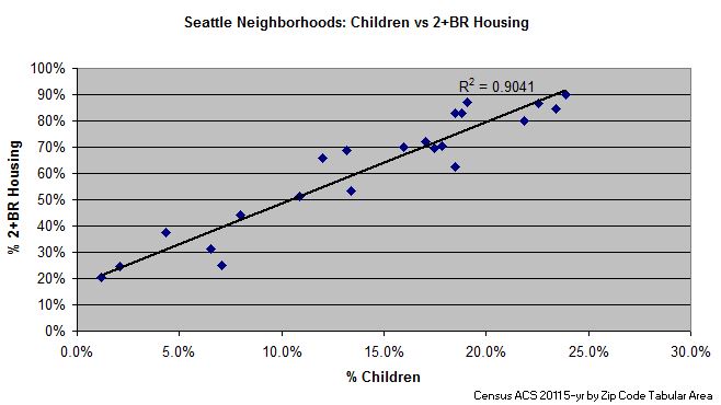
A study by the community organization Sustainable Neighborhoods of North Central Austin (SN) found a medium to strong correlation between multi-bedroom housing, and the percentage of children. The study evaluated ACS 2011 census data for over 300 neighborhoods in eight US cities.

Seattle housing vs kids

To achieve even the US average of children in the population, which is 24%, the SN study found that a community needs to have at least 75-80% dwelling units with two or more bedrooms. For comparison, Downtown Austin has 41% multi-bedroom units, and just 3-4% children.

Not every Austin neighborhood needs to be age-balanced. But where neighbors like in District 7 are demanding it, the City of Austin needs to adjust its policies to enable this goal. A Council member who understands and champions this policy would go a long way.

The Shaping of District 7 – An Allandale Perspective

district 7 map by Tom Linehan, The Allandale Reporter

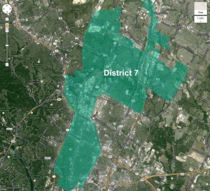
District 7 is shaped like a pork chop! Looking at the final draft of the city council redistricting map drawn up by the Independent Citizens Redistricting Commission (ICRC), the bulk of Allandale is in District 7 whose boundaries form a narrow band north of 45th Street between Lamar and MoPac up to 183 where it then expands west of MoPac, and a little further north of that it extends east of I-35. The northern boundary of the district goes up to Howard Lane and parts of it to Wells Branch Parkway. That’s pretty far north and the northern section comprises a large section of District 7.

The portion of Allandale not in District 7 is the small area between 45th Street and Hancock, west of Bull Creek. It is in District 10. That means Allandale will have two city council members to influence. It also means two council members invited to march in our annual 4th of July parade.

The first map the ICRC created had District 7’s boundaries stretching down to Lady Bird Lake west of MoPac encompassing Tarrytown. Gerrymandered you say? Well, after asking around, I am left with the impression that the shape of District 7 in the preliminary map released September 28 came about more because all of the other districts were drawn first and district 7 was what was left. That’s not exactly what happened, but close. The initial map had District 7 spanning Lady Bird Lake north to Pflugerville.

So the question now is whether Allandale’s interests are better aligned with the folks in Tarrytown or our northern neighbors? Most of the Allandale people I spoke with who were active in the process, prefer sharing the district with the suburban neighborhoods north over the more urban, near downtown neighborhoods south, however Allandale’s primary interest throughout the process was to be in the same district as our close-in neighbors. That is what the Allandale Neighborhood Association’s (ANA’s) redistricting committee and other interested Allandale residents told the ICRC in response to the initial map. Chris Hayden, chairperson of that committee, submitted ANA’s resolution and spoke in support of it at one of the ICRC public meetings. The resolution conveyed ANA’s preference to be aligned with neighborhoods like Brentwood, Brykerwoods, Crestview, North Shoal Creek, Oakmont Heights, Ridgelea, Rosedale, and Wooten. When the ICRC came out with the second draft of the map on November 6, it appears they listened. The southern border of District 7 was cut off at 45th Street. Tarrytown was moved into District 10.

To elaborate on why the preference for aligning with neighborhoods north of us over the ones south, Steven Zettner, who was involved early on in rallying interest in the redistricting process said: “Our neighborhoods are early suburban, and infill development here has different requirements from downtown.” The desire, he explained is “a council district where the council member could specialize in early suburban challenges, undistracted from the different challenges faced by areas in or near downtown.” Some of those challenges that came up in my talk with Steven and others in Allandale include the transportation corridors along Burnet Road and Lamar Boulevard, in-fill development (probably the most complex challenge of them all), preserving family-friendly neighborhoods, and maintaining an age- and income-balance.

As ANA’s president, David Mintz, pointed out, “the district boundaries that the city council approves will shape our representation at City Hall for a number of years so it is important that we align ourselves with neighborhoods that share similar concerns.” David Orshalick, who was one of the more involved residents in the process, said: “We want the council member in our district to experience our pain when it comes to issues like transportation.” David was a big supporter of single-member districts. “Representation at City Hall,” he says, “should be much more neighborhood friendly going forward because council members will be elected from all areas of the city and not just from the central city.”

Those close to the process are generally pleased with the outcome of the redistricting maps. While Allandale is not in with all of the neighborhoods it originally wanted, specifically the ones south of 45th: Rosedale, Brykerwoods, Ridgelea, and Oakmont Heights, it did keep a majority of them. They would have preferred the northern border to have stopped at Parmer Lane however, given all of the challenges the Commission faced making the map, one of which was having roughly 80,000 residents in each district, no one could offer a better alternative.

Now that the districts are drawn, let the council candidates come forward. We have much to discuss. Allandale is being asked to put together a neighborhood plan. There are concerns about a Burnet Road bar district. We want to know how the rewrite of the Land Development Code is going to affect our SF-2 zoning? Is a pedestrian, family-friendly Burnet Road an oxymoron? Bring ‘em on! Who is ready to run for city council office in the pork chop District?